The parcels at 471 and 473 Boston Post Road that comprise the former capped Old South landfill have been floated as town-owned land available for potential redevelopment for many years by multiple town groups with space desires. There are minimal options for town-owned buildable sites that are not already in municipal use for schools, libraries, housing, DPW, public safety, playing fields and water utilities. As the desire of residents for additional town services and amenities expands, there are no easy or obvious options, so the debate over the former landfill site’s future is ongoing.

The Route 20 Old South Landfill Visioning Committee was formed in 2020 to begin a formal assessment of the parcels. At the September 15 Select Board meeting, the advisory committee members were reappointed for terms ending in Feb. 2026. At the next R20SLVC meeting scheduled for October 10, the status of the work by consultants Weston & Sampson on the site’s physical properties and The Collaborative on best uses for the property will be reported.
Town-owned properties
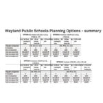
The 2017 Wayland Real Asset Planning (WRAP) Committee Report inventoried approximately 320 town-owned parcels, identifying the custodial holder, size, current uses, and (for the larger parcels) deeds, orders of taking, plans, town meeting actions, deed/use restrictions and environmental constraints. This planning effort was envisioned in the original 2004 Master Plan 2004 and in the 2011 update. For the report site assessment and evaluation matrix, see tinyurl.com/wpwrap.
Removing properties in current use and reducing the inventory list to the largest parcels leaves the following: 195 Main St. (old DPW), the Paine Estate/Greenways parcels, the Route 20 old landfill parcels, the Orchard Lane Parcel, and the Town Center “town green” parcel. All of these properties have potentially encumbering issues such as legal restrictions, environmental concerns or a challenging physical site that raises the costs of any development.
The 2025 Council on Aging/Community Center was built on the “municipal pad” at Town Center. The 2023 Loker grass field was constructed at the Loker Conservation and Recreation Area, further reducing the town’s options in the inventoried list.
Route 20 Old Landfill
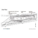
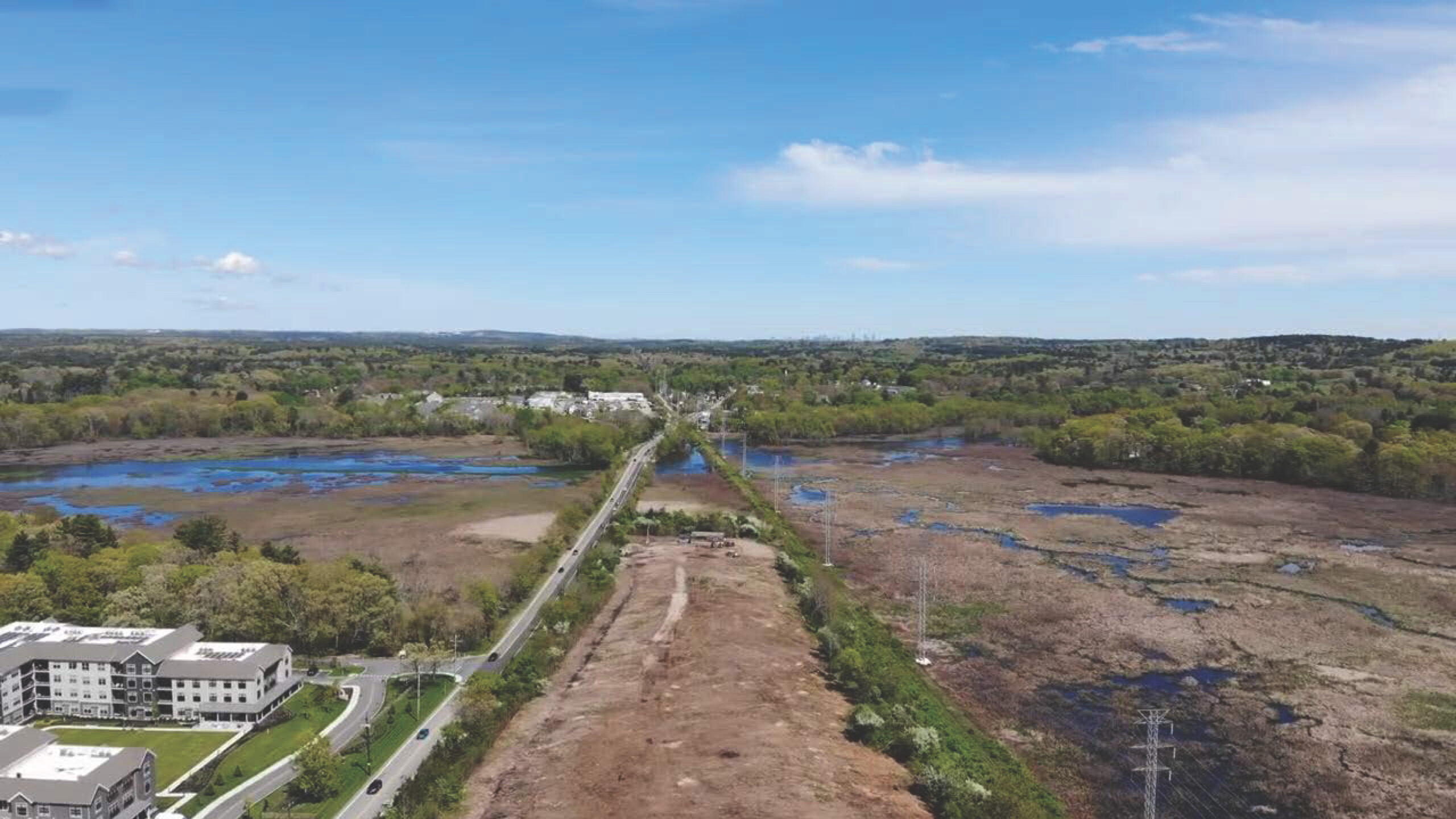
Traveling west on Route 20 past the Sudbury bridge on the south side of the road, the 17-acre property begins and continues up to the east side of the Richey & Clapper machine and tool rental property, with the railroad tracks and Wash Brook forming its southern border.
As part of the consideration of where the school buses might be parked after being ousted from the location at the septage facility parcel where Alta Wayland (formerly River’s Edge, Alta Oxbow) is now located, Weston & Sampson in 2018 started a landfill cap investigation and consultation with the MassachusettsDEP.
After its closure in 1980, vegetation gradually regrew over the capped landfill. MassDEP wanted the cap remediated so a permit application was submitted, and they required more data before any legal change of use status would be considered. DPW removed the abandoned building trailer and stripped the vegetation away in 2023-24.
Collaborative’s suggested plan
At the March 6, 2024 Visioning Committee meeting, consultants Ed Shoucair and Kaye Lynn Johnson from The Collaborative presented their approach to fulfilling the community’s current and future needs, as well as how the land could contribute to improving the quality of life and enhancing fiscal benefits.
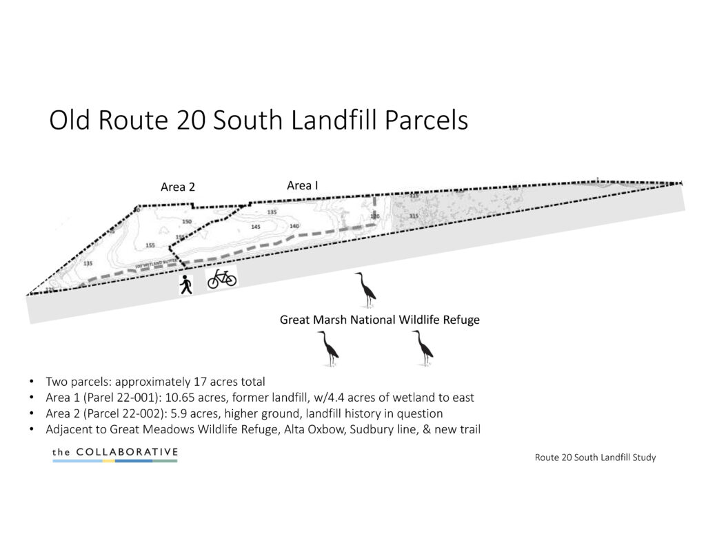
Shoucair showed a map of two parcels: the eastern Area 1 of 10.65 acres (parcel 22-001) and the western Area 2 of 5.9 acres. He contended that the 17 acres should still be highly prized for its location, offering a southern view of Great Meadows Wildlife Refuge, Wash Brook, the Sudbury River, and potential access to the rail trail, despite its history as a landfill.
After consulting town officials at the DPW, School Department, Recreation Commission and Housing Authority, Shoucair and Johnson concluded that the most beneficial use for the town would be housing.
On March 29, 2024, Shoucair and Johnson presented a two-phase redevelopment concept. Their plan divided the site into two areas. In Area 1, any redevelopment here would have to be limited to a disturbance of the capped surface, meaning paved areas or open spaces. Area 2 was potentially suitable for traditional building foundations. The consultants recommend starting with recreation and some housing in Area 2 while leaving Area 1 for potential future development.
Further discussions with the Mass DEP led to testing performed by Weston & Samson to establish the perimeter of the landfill boundaries, as the old landfill records were inadequate. The latest rounds of several test pits and borings are scheduled to finish by the end of 2025, according to Town Engineer Paul Piccioli.
The latest exploratory borings are investigating around Area 2 on the northern fence line and from the gate to the embankment of the train tracks area to determine the trash depth. The boring data will be shared with MassDEP for a better understanding of the costs and issues associated with removing a potentially shallow layer of trash to facilitate possible future development.
Environmental hurdles
Most of the property lies within a 200-foot riverfront buffer zone as defined by the Massachusetts Wetlands Protection Act, meaning any significant work would require an environmental review and possibly a Notice of Intent filing with the Conservation Commission. The site is also subject to Massachusetts Endangered Species Act regulations, since rare bird species have been observed there.