(Editor’s note: the first installment of this 10-part series appeared in the Wayland Post on Sept. 11, 2026. Read it online at www.waylandpost.org/postcards.)
Dear readers,
Past historians linked the word “Cochituate” to rushing torrents, rapids, and waterfalls. However, Cochituate Brook, a tributary to the Sudbury River, is usually sluggish. Intrigued by the mismatch between the descriptions and the landscape, I asked Ives Goddard, the leading expert on Algonquian languages, for a linguistic analysis. He said it is a compound word made of Kutche, which means “more,” and kussehtanip, translated to “stream.” He suggested it means “additional stream, or tributary.” Likewise, Lake Cochichewick in North Andover, also in the Massachusett territory, is a tributary of the Merrimack River. Given the linguistic analysis, the similarity of the words used to label these two tributaries, and the mismatch between other suggestions and the landscape, I think Dr. Goddard’s interpretation of the meaning holds more water than the others. However, the question of form also warrants an explanation.
Frank Waabu O’Brien, Ph.D., an expert on Native American placenames in New England, told me colonists often corrupted pronunciations and spellings of indigenous place names when they misheard, mispronounced, or misrepresented what they heard. He also said 17th-century New England documents and maps show spelling variation because people did not always follow strict writing conventions. Following that logic, the current word, Cochituate, may have deviated from the original Algonquin form. I believe the two lakes once shared the same name and that linguistic corruption may have caused their current names to diverge. One thing I know for sure is that Cochituate is the only place called “Cochituate” on any map I’ve ever seen.
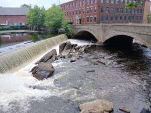
P.S.: The main photo shows the outlet of Lake Cochituate where it meets Cochituate Brook. The photo on the stamp shows the area from Town Beach. According to historical accounts, an indigenous site called Cochituate stood at the top of the hill. It was destroyed during the construction of the Massachusetts Turnpike in the mid-1950s.
Sincerely,
Sheila Carel (Wayland Post Contributor)